


Bodcaw Rural Voting District, Nevada County, Arkansas
About
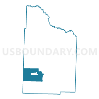
Outline

Summary
| Unique Area Identifier | 527431 |
| Name | Bodcaw Rural Voting District |
| County | Nevada County |
| State | Arkansas |
| Area (square miles) | 33.93 |
| Land Area (square miles) | 33.87 |
| Water Area (square miles) | 0.06 |
| % of Land Area | 99.81 |
| % of Water Area | 0.19 |
| Latitude of the Internal Point | 33.54372790 |
| Longtitude of the Internal Point | -93.43212200 |
Maps


Graphs
Select a template below for downloading or customizing gragh for Bodcaw Rural Voting District, Nevada County, Arkansas


Neighbors
Neighoring Voting District (by Name) Neighboring Voting District on the Map
- Alabama Voting District, Nevada County, AR
- Bodcaw City Voting District, Nevada County, AR
- Bodcaw Voting District, Hempstead County, AR
- DeRoan Voting District, Hempstead County, AR
- Union Voting District, Nevada County, AR
- Willisville Rural Voting District, Nevada County, AR
Top 10 Neighboring County Subdivision (by Population) Neighboring County Subdivision on the Map
- De Roan township, Hempstead County, AR (13,406)
- Parker township, Nevada County, AR (628)
- Taylor township, Nevada County, AR (524)
- Bodcaw township, Hempstead County, AR (511)
- Alabama township, Nevada County, AR (279)
Top 10 Neighboring Place (by Population) Neighboring Place on the Map
Top 10 Neighboring Unified School District (by Population) Neighboring Unified School District on the Map
Top 10 Neighboring State Legislative District Lower Chamber (by Population) Neighboring State Legislative District Lower Chamber on the Map
Top 10 Neighboring State Legislative District Upper Chamber (by Population) Neighboring State Legislative District Upper Chamber on the Map
- State Senate District 21, AR (74,633)
- State Senate District 20, AR (73,443)
- State Senate District 26, AR (68,899)